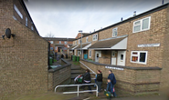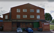
Hemmingwell welcome sign and noticeboard
Hemmingwell is a large, densely populated council estate and former electoral ward in north Wellingborough, Northamptonshire in England. The area has a population of 8,272 people as of the 2011 census. Hemmingwell is often referred to as "H Way", "The Well" or "Little London". Since the late 20th century, Hemmingwell has consistently held one of the highest poverty and crime rates of any neighborhood in Wellingborough.[1]
Character[]
Hemmingwell is a large, urbanised and very densely populated area. It is also mostly a working to middle-class area. The estate is busy during the day but relatively quiet during the night in terms of traffic. The area is very culturally and ethnically diverse. Poverty and crime however, is a problem in the area.
History[]
The area that would become Hemmingwell was first used for farming and allotments, and was known as Hemmingwell Farm. However in the late 60s and early 70s the allotments were removed and construction of the estate begun. The estate was built adjacent to the estate known as 'The Pyghtle', which was built in the 50s. Hemmingwell Road connects the two estates. Hemmingwell was then expanded again in the 90s and 2010s. From the 80s until the early 2000s, strong putrid fumes from Chettles animal carcass infirmary and pet food factory along Ditchford Lane would usually blow upwind into Wellingborough, particularly eastern Wellingborough and Hemmingwell. Chettles however, took control of the problem in the early 2000s due to numerous complaints. During the 80s, Hemmingwell gained a reputation for violence and poverty, a reputation that persisted through the 21st century, and since the 90s, the area has been seen as a breeding ground for crime, as well as becoming locally associated with 'Chav culture'. Hemmingwell's crime rate peaked during the 90s and people were often scared about going outside on the estate at night. In 2014, the estates garages and parking areas were redesigned to be more open to reduce crime. For example, walls were removed or replaced with fences and barricades. This meant that people were less likely to commit crimes in the parking areas as it was an open area and no longer enclosed. Although Hemmingwell's crime rate peaked in the 90s, since 2018 crime has noticeably increased on the estate.
Crime[]
Hemmingwell has consistently been considered to be the crime capital of Wellingborough. Northamptonshire Police have put in place several operations to reduce crime on the estate.
Demographics[]
In the 2011 census the population of Hemmingwell was 8,272 and is made up of approximately 51% females and 49% males.
The average age of people in Hemmingwell is 36, while the median age is lower at 35.
81.5% of people living in Hemmingwell were born in England. Other top answers for country of birth were 2.4% India, 1.3% Scotland, 1.0% Kenya, 0.8% Zimbabwe, 0.6% Wales, 0.5% Ireland, 0.5% Bangladesh, 0.4% Jamaica, 0.4% South Africa.
90.3% of people living in Hemmingwell speak English. The other top languages spoken are 3.2% Polish, 2.5% Gujarati, 0.5% Bengali, 0.3% Urdu, 0.2% Swahili/Kiswahili, 0.2% Shona, 0.2% Portuguese, 0.2% Arabic, 0.2% All other Chinese.
The religious make up of Hemmingwell is 53.4% Christian, 29.1% No religion, 6.7% Hindu, 3.0% Muslim, 0.3% Buddhist, 0.3% Sikh, 0.1% Atheist.
520 people did not state a religion. 18 people identified as a Jedi Knight.
48.3% of people are married, 12.1% cohabit with a member of the opposite sex, 0.4% live with a partner of the same sex, 23.7% are single and have never married or been in a registered same sex partnership, 8.9% are separated or divorced. There are 393 widowed people living in Hemmingwell.
The top occupations listed by people in Hemmingwell are Elementary 16.9%, Elementary administration and service 14.8%, Professional 12.3%, Administrative and secretarial 12.0%, Process, plant and machine operatives 11.3%, Associate professional and technical 11.0%, Managers, directors and senior officials 10.4%, Administrative 9.7%, Skilled trades 9.2%, Caring, leisure and other service 8.7%.
Parks and Recreation[]
- Hemmingwell Skatepark
- Hemmingwell Basketball Court
- Guillemot Park and Play Area
Education[]
- Cygnets Pre-School
Transportation[]
Public Transportation[]
The area is well served by public transportation, it is served by Stagecoaches W2 bus[2] and the estate is in close proximity to Wellingborough railway station.
Roads[]
List of roads on the estate:
- Blackbird Court
- Fulmar Lane
- Gannet Lane
- Guillemot Lane
- Kestrel Lane
- Kingfisher Close
- Kittiwake Close
- Linnet Close
- Nest Lane
- Nest Farm Crescent
- Nest Farm Road
- Nursery Drive
- Nightingale Lane
- Osprey Lane
- Robin Lane
- Sandpiper Lane
- Shearwater Lane
- Swallow Close
- Teal Lane
- Thrush Lane
Name[]
Hemmingwell was named after the farm it was built on which was called Hemmingwell Farm. The estate was given this name in the late 60's because when they expanded the estate they built the expansion on what was known as Hemmingwell Farm and before the expansion, the estate had no name.
Trivia[]
- There was once a lake in Hemmingwell between Kittiwake Close and Nightingale Lane. It was removed however, due to people dumping litter in the lake. In it's place is now a patch of grass.
- Planning permission for the estate was submitted on 01/01/1965, the plans where approved on 14/06/1967 and construction commenced shortly after.
- Before Hemmingwell was expanded, the land was used for allotments, the majority of these were removed however many allotments still remain to the east of the estate between Nest Lane and Finedon Road, as well as at the end of Kestrel Lane.
- Hemmingwell's postcode area is NN8-4 which mostly covers north and north-east Wellingborough.


